One of our more ambitious trips of 2013, the Black Mountain High Route is a little known traverse of a rugged ridge system directly west of Glacier Peak. It was described in Tabor and Crowder's book Routes and Rocks: Hikers Guide to the North Cascades from Glacier Peak to Lake Chelan, published in 1965 by The Mountaineers.
Our plan was to take Lost Creek Ridge to the Black Mountain High Route, then take the PCT to the Blue Lake Trail for five days of ridge walking, making a nice "C" around the upper North Fork Sauk drainage. I chose this route because, of the ones on my list, it was the furthest west. There had been a lot of thunderstorm activity, with more in the forecast — the probability being lower the further west one stayed.
A week before the trip I injured my foot walking 16 miles of rocky trail with a 4,000 ft descent in unpadded barefoot shoes. Oops. I was still walking with a limp the day before we left town, just carrying gear out to the car. It seemed like there was a good chance I wasn't going to make it very far.
Lost Creek Ridge
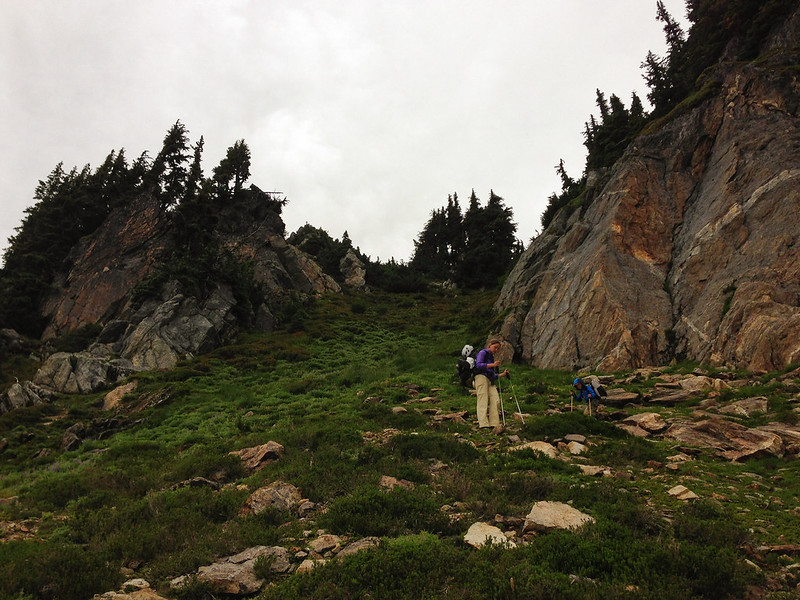
We slept in our tent in a parking lot at a trail head on the Mountain Loop Highway, and were awakened in the middle of the night by arriving hikers who must have been planning to watch the sunrise from the top of a peak. In the morning we used the picnic table to organize and pack before driving to the Lost Creek Ridge trail head. I'd done some shoe tests at home and determined that my stiff approach shoes provided the most protection for my foot. I donned them reluctantly and packed some extra ibuprofen, prepared to hobble back out the next day if the first day didn't go well.
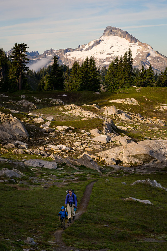
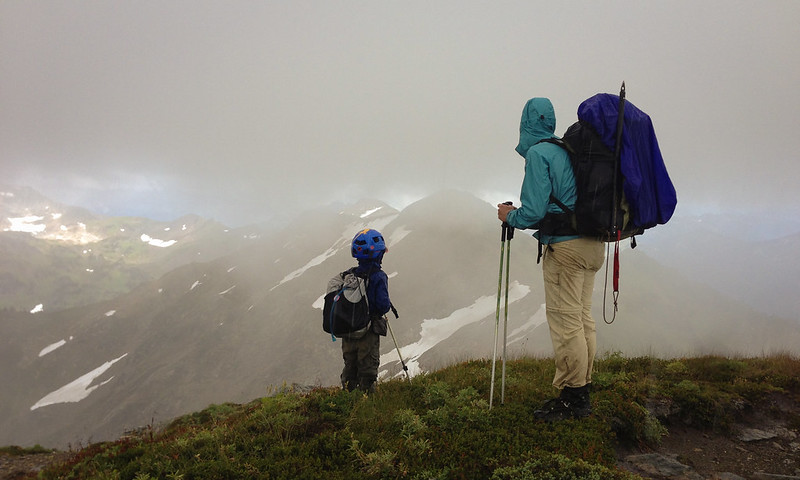
It was around 10am when we started walking. Fortunately, my foot held up well enough. The faint trail stayed to either side of the ridge, and low clouds blocked the views most of the day, but it proved to be a nice walk. We arrived at Camp Lake near the end of our first ridge hungry and ready for dinner, and had the lake to ourselves for the night. The sky cleared by morning, and Mt Baker was visible in the distance from our picturesque campsite.
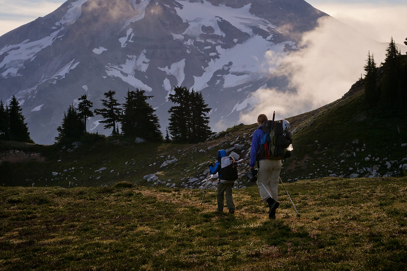
We tried to get an early start, but didn't manage to be packed up and walking until 7:45am — and that was without breakfast. As we crested a hill before dropping to Lake Byrne, Glacier Peak came in to view, towering above us. Looking back the way we came, glacier clad Sloan Peak stood proudly in the morning light. At Lake Byrne we stopped to tank up on water and make breakfast while we gazed up at Glacier peak across the White Chuck River valley.
The High Route
Tabor & Crowder show the route going around the west side of Lake Byrne, but the East side looked like the obvious choice, so that's where we went. It was mostly straightforward, except for a short section near the far end that was steep, wet and heavily vegetated. This was just a brief introduction to the terrain ahead. By the time we had our breakfast stop, navigated around the lake, and climbed the ridge it was 11:30am.
From this vantage point we had our first real view of the north half of the high route, and the terrain looked reasonable. In the tent the previous night I reviewed the route, only to discover that the route description hadn't synced to my phone. I did have a digital copy of the USGS Quad from the book which showed the route. The description was from South to North anyways, and we were headed the opposite direction.
Dropping off the ridge we stayed a bit high and were cliffed out within 40 minutes. We traversed down to the elevation shown on the map, only to be standing on top of the same cliff band. I dropped my pack and went scouting, something that became a common occurrence. I bushwhacked several hundred feet down the steep slope before finding a way around the bottom of the cliff band. We'd brought a pair of two-way radios, and ended up getting a lot of use out of them on these frequent scouting diversions.

The map above is from Routes and Rocks (routes drawn in purple). I've overlaid some of our known coordinates with timestamps on the map (red from GPS, black estimated from photos). I've also highlighted the two major problem sections showing south Facing cliff bands in grey.
Past the first significant difficulty, we arrived in a lovely basin at 2pm. My foot was starting to hurt so I stopped and soaked it in the icy creek while Linette and Ethan began the climb out of the basin. There was no way down from the obvious notch we climbed to above the basin, but scouting along the ridge revealed a way down. We enjoyed a section of easy walking along the open rocky slope before encountering a swath of trees that descend from the ridge, which obscured the next major cliff band.
We were again standing at the edge of a cliff at precisely the elevation indicated on the map. I couldn't tell how high or low the cliff ran, but going lower seemed infeasible. The cliffs bordered a large gash in the mountain, which was flanked by cliffs on the other side lower down. I dropped my pack again and headed up while Linette and Ethan had a snack. I climbed the 500 feet to the ridge crest before finding a way through. 500 feet back down to my pack. 500 feet back up to the ridge a second time.
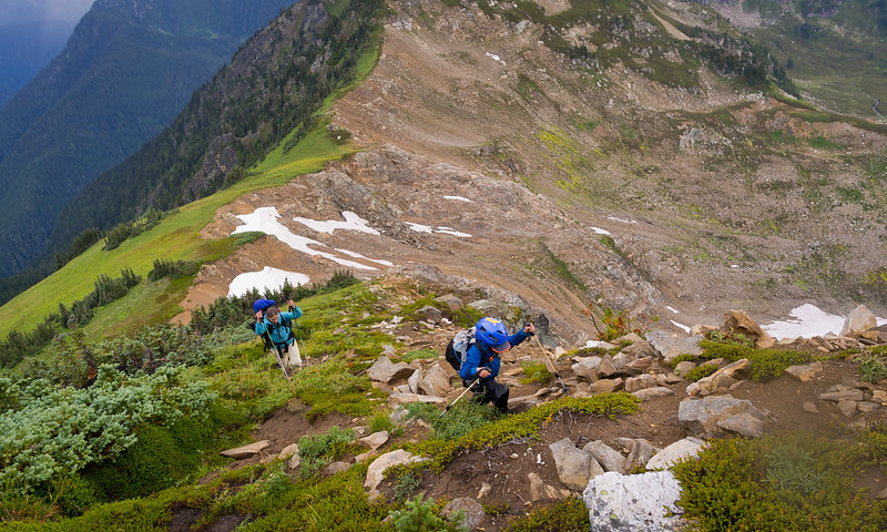
The photo above shows the upper end of the cliffs just discussed. It's conceivable that these cliff bands could be navigated when approached from the below (heading North), but I wonder about changes in the terrain in the intervening 50 years since Routes and Rocks was published. They also didn't have the benefit of GPS, so perhaps their map was a little off.
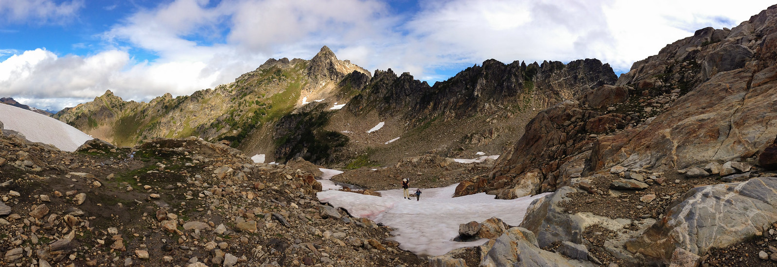
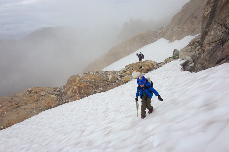
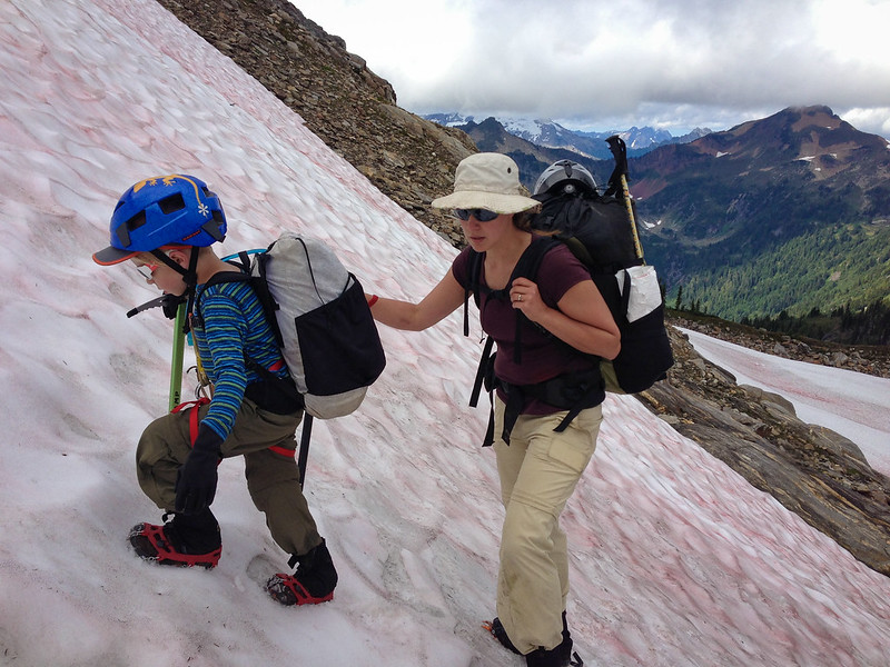
The second major obstacle surmounted, we traversed easy terrain around the base of the rib on the NW side of Black Mountain to the snowy basin directly West of the summit. At this point it was after 5pm, we were getting tired, and we had a high ridge to cross before the next potential campsite. We got out our axes, put on our crampons, and headed up the 500 feet of snow towards the ridge, hoping I picked the right notch. I took off ahead so I could reroute Linette and Ethan before they got to the top if necessary.
Fortunately, I picked the correct notch, and there was a flat meadow 1,000 feet below. I went back with the rope to help Ethan up the steepest section of snow near the top, then we started down the precipitous green slope thinking about dinner and flat ground.
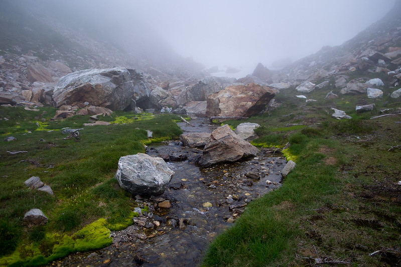
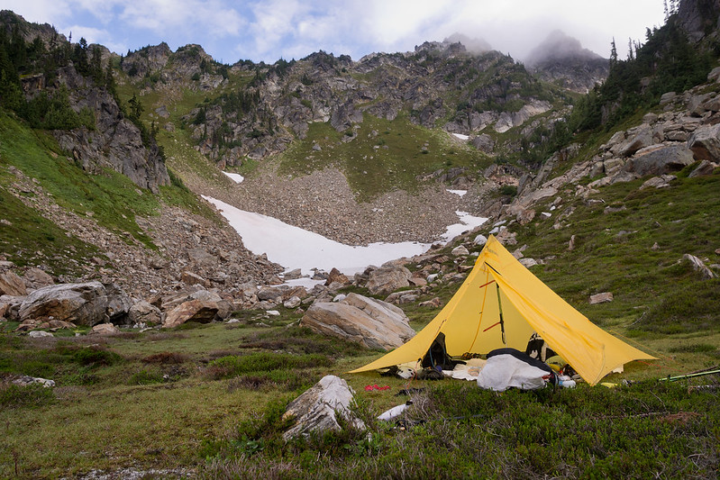
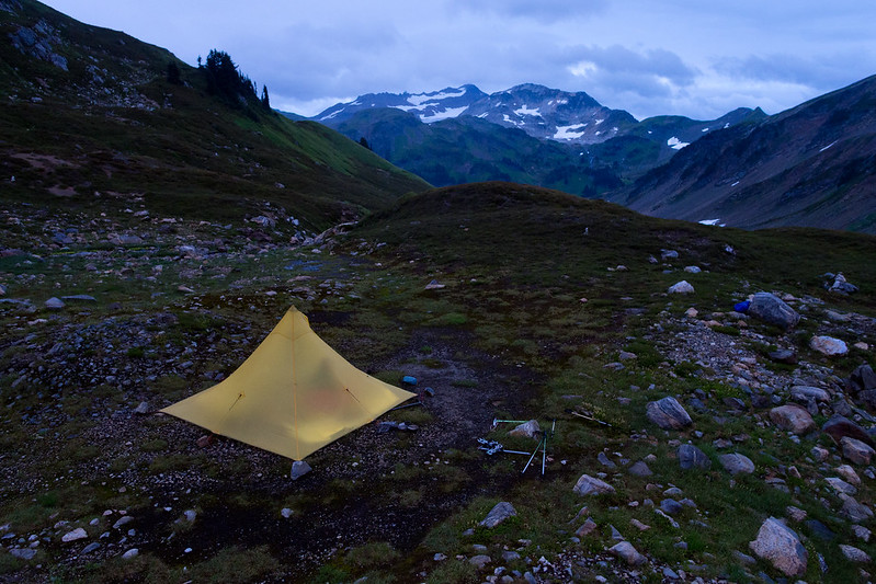
We took our shoes off and walked around on the spongey ground barefoot as we set up camp. A cloud dropped into the basin, and enveloped us in a foggy mist. The feeling of being somewhere rarely visited by humans was intense. After dinner by the creek, we cleaned up and went to bed.
The High Route, Day 2
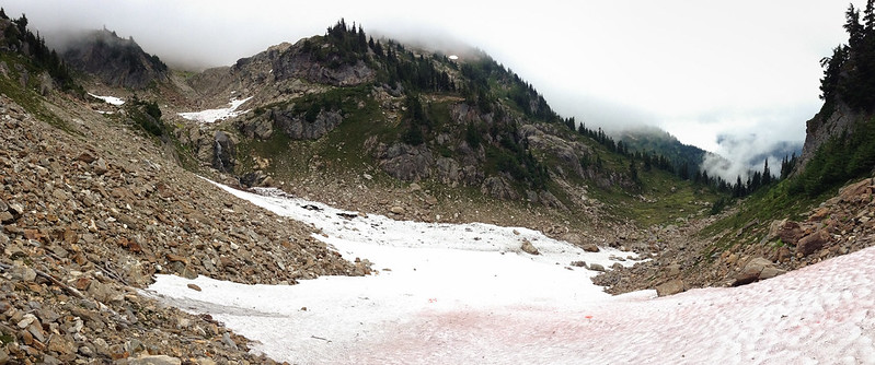
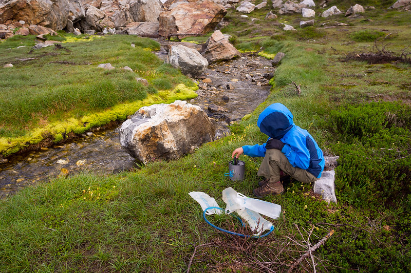
After a peaceful nights sleep we woke up to the sound of the little stream. We took our time getting ready, and by the time we finished breakfast and camp chores and got packed up it was 9am. As we headed up into the rocky basin it was hard to choose whether to look down at the brilliant green moss and colorful rocks under foot, or up at the jagged ridges surrounding us.
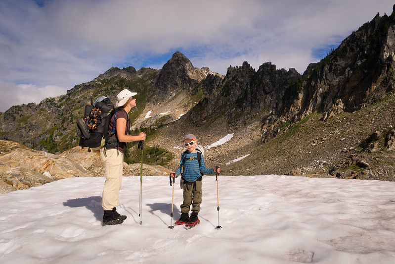
Once in the upper basin, we were confronted with more route finding guesswork. Based loosely on the map, and mostly on intuition, I picked a target on the ridge. We got out the crampons and axes again and headed up the permanent north facing snowfield. I put Ethan on short rope for a brief traverse, and the final steep section.
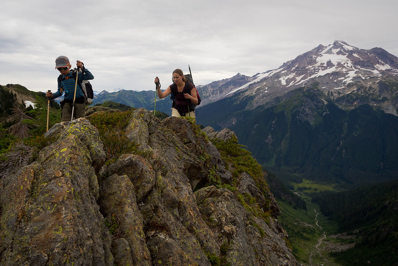
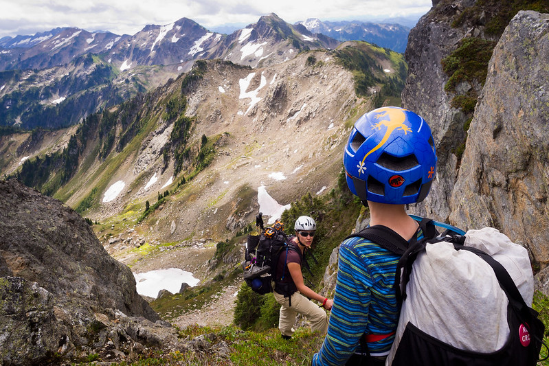
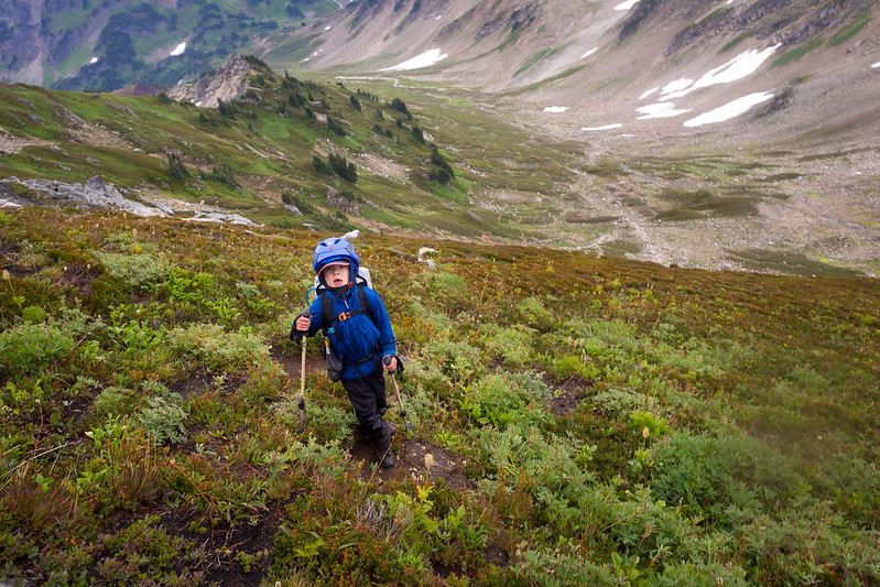
The other side of the notch was again green and steep. From this vantage we could see a new set of peaks, and the majority of the rest of our route. The more rounded and vegetated ridges looked like easier walking, which was a welcome sight. We had a snack before heading down, with crampons still on, axes still at the ready.
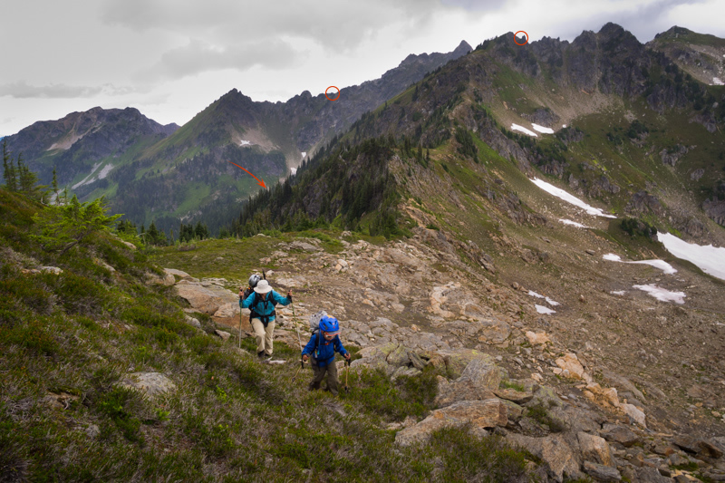
The image above provides a good view of the route behind us. The red circles show where we crossed the ridges and the arrow indicates the basin where we camped. The preceding photo shows the route ahead, with Skullcap and Portal peaks in the distance.
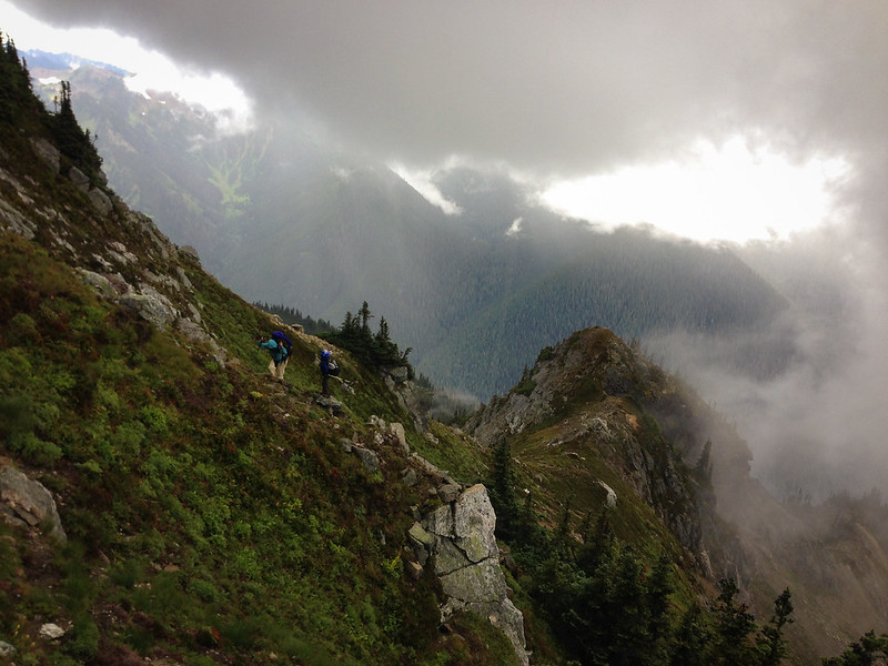
The traverse over to the south trending ridge line was difficult, and we immediately had to drop back off to bypass a rock outcrop. Maybe this wasn't going to be easier after all. We picked up a goat path and made better progress for a time as the sky began to darken, and then a cold rain began to fall. We huddled under some stunted trees and tried to shield our pack openings with our bodies as we accessed their contents for lunch.
Another route finding challenge was encountered as we approached Skullcap Peak. The north ridge is a mix of dwarf trees and gendarmes, and the northwest slope is exceptionally steep (and now very wet) heather and brush. The rocky ridge was clearly a bad idea in the rain, so we somewhat grudgingly lost elevation and made a long traverse across the slippery northwest slope to bypass cliffs and brush.
The angle stayed steep. The sun occasionally broke through the dark clouds making for some incredible lighting. After a brief scramble we were on top. We paused on the summit of Skullcap to take in our surroundings. Then down, which was fast and straightforward for a change.
One more peak to go. As we headed up Portal Peak, our last high point before intersecting the trail at Red Pass, there was a rumble off in the distance. Suddenly the black clouds to the west were moving towards us, and thunder was echoing off the ridges. We were on an exposed peak and the only way to go was up and over.
We picked up the pace, and Ethan practically flew to the top. I snapped a few photos on the move and then we were running off of Portal Peak towards Red Pass. We had to slow down for some steep scree, and one of us took a slip on the rocks. Despite the rush, I spotted the only goat of the trip on the east shoulder of Portal Peak.
Arriving at Red Pass we realized our distressing shortage of options. The trail from here makes a high traverse along the west side of the ridge to White Pass. The basin to our West, straight towards the storm, offered a couple of small groups of trees, and little else. The basin the trail descends to the East is a beautiful barren valley that resembles Alaskan tundra.
We stood at the pass, unsure what to do. Probably prompted by a clap of thunder, we turned our backs to the storm and made a swift descent into the upper White Chuck. Not wanting to descend too far out of the way, and not sure we would find more flat ground, we set up our shelter in the barren basin and climbed in to escape the now pouring rain.
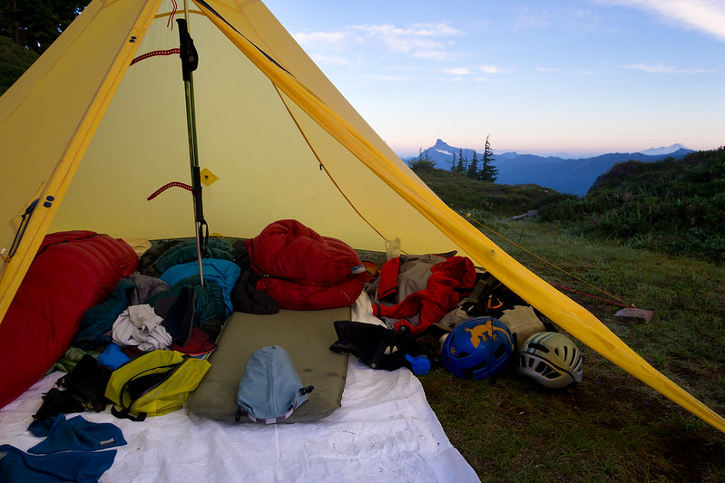
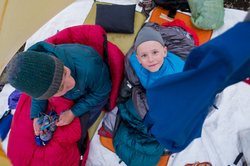
Before long, our flat spot was a shallow stream. Then the wind ripped one of the corners of the pyramid loose. Fortunately the thunder subsided, and then the rain slowed. We were now sitting on our Thermarests in the middle of a puddle, and our ground sheet and most of our gear was soaking wet and covered in mud. Our situation felt oddly humorous.
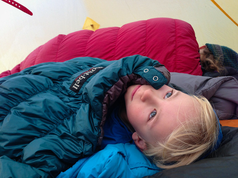
We debated packing up and hiking out the North Fork of the Sauk in the approaching darkness, but there were no hot showers, warm food, or dry shelters waiting for us, and it was a good 16 miles to our car. After some hot soup we were all in better spirits, and we eventually managed to get our sleeping pads and ground sheet cleaned up reasonably well. Linette got in some knitting, and I got in some post storm photography.
Early Exit
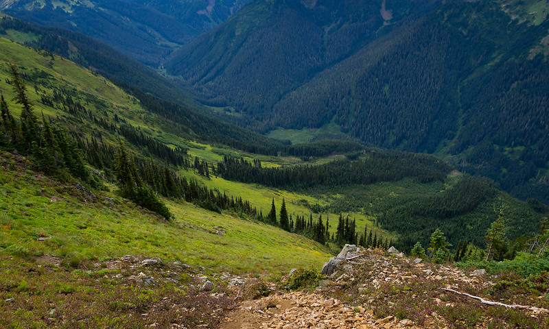
Our planned route involved another 20+ miles of ridge walking via the Blue Lake Trail. However, morning came cloudy, we were low on food, and I was limping again. We might have toughed it out if the weather was more inviting, but we decided to walk out the North Fork Sauk, only 11 miles of mostly downhill to the trail head.
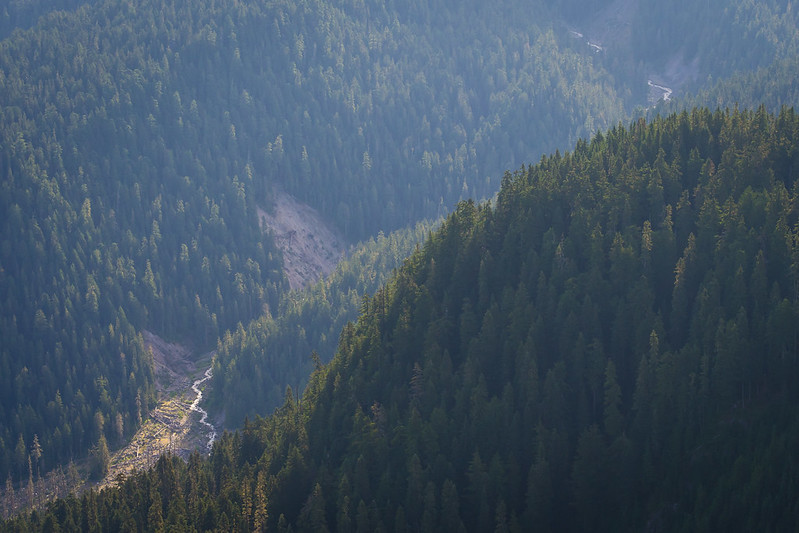
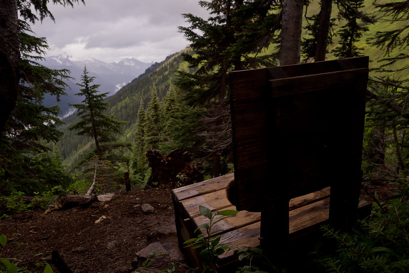
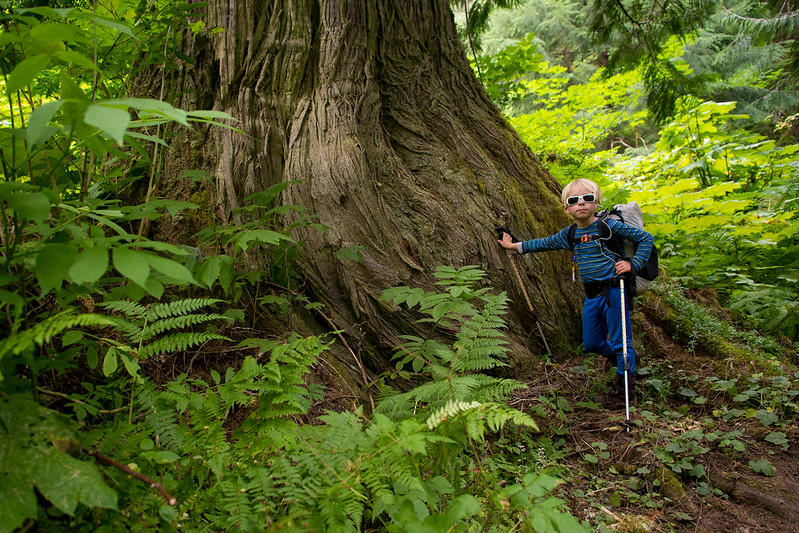
We made a detour to White Pass and visited the mountain toilet there before starting down. The marmots, which had been a constant presence the entire trip, were everywhere on this section, even walking down the trail in front of us. After descending, we took a break near the Mackinaw Shelter by the river. As if to reinforce our decision, another thunderstorm rolled thru in the afternoon. It was much more enjoyable safely in the valley amongst the old growth giants.
I was hoping to find a ride to our car, but there were few cars in the trail head parking lot, and no people around. We decided to wait for a while and see if anyone showed up. A couple of guys with the forest service arrived in a truck, and set off to take care of a smoldering campfire that had been reported several miles up the trail, but that was it.
Since my foot was slowing me down considerably, Linette volunteered to go get the car before it got dark. She made good time and returned with the car before any other opportunities for a ride came up. We decided to just stay at the primitive campground at the trail head which was empty. We spent the evening trying to organize and make dinner in the rain.
Eager for breakfast, we packed up in the morning and headed to Darrington, the nearest town an hour away. We were disappointed to find that there wasn't a single restaurant in the lame little town. Continuing north to highway 20 we detoured west to Concrete, lame little town number two, where the only restaurant was closed. We headed east to Marblemount where we knew from past experience that there were a couple of places to eat, and finally got our bacon and eggs.
After breakfast we drove over Rainy and Washington passes to spend the next five days on the east side of the mountains. However, the views of green ridges, the sound of marmot calls, and the taste of endless huckleberries would stay with us for a long time.